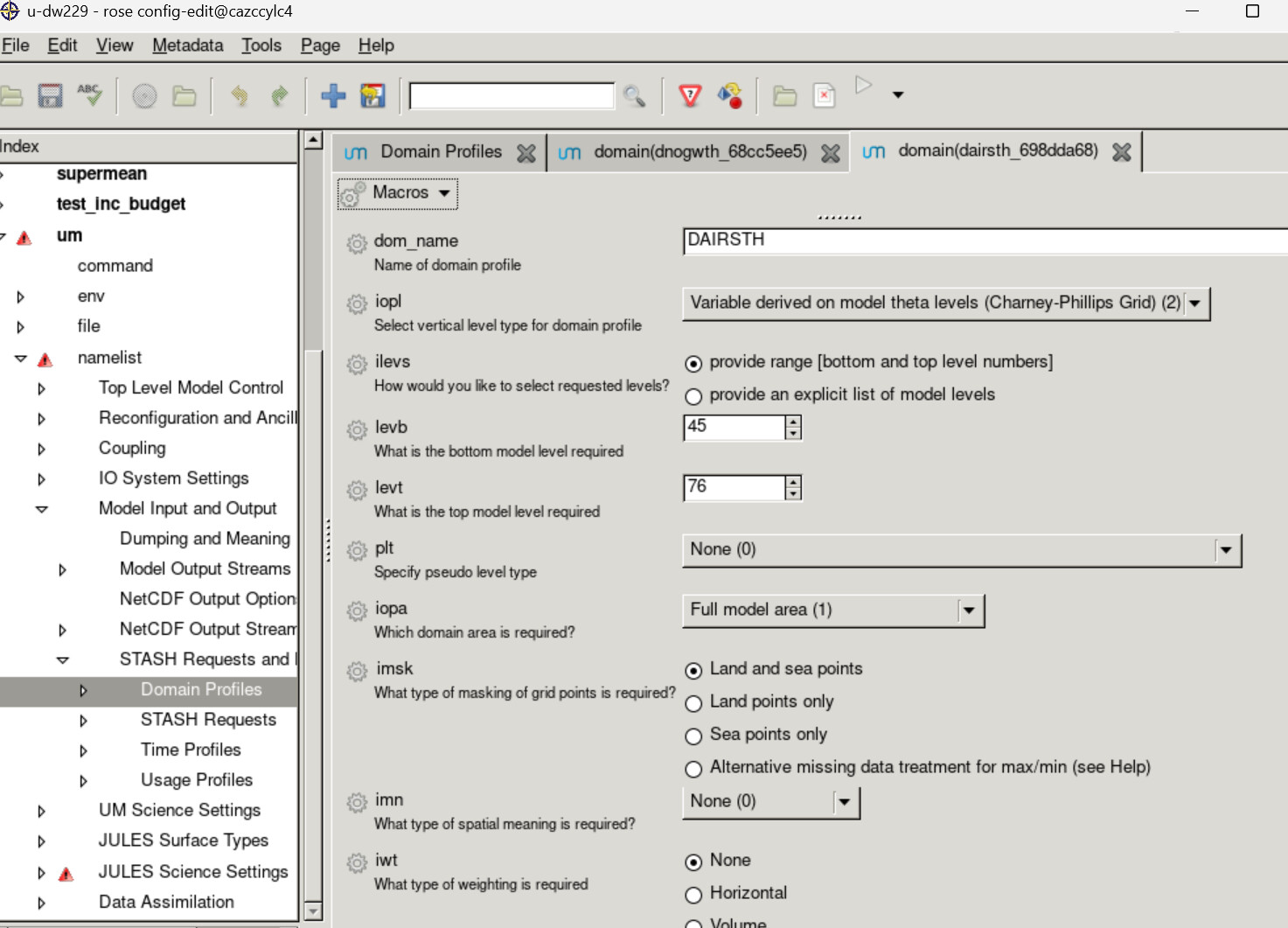
Hello! I am trying to define a custom domain profile to output STASH only between 15 km and 45 km to help keep the file sizes reasonable while outputting hourly data.
I have defined the domain profile as shown in the screenshot. When I look at the output STASH, it only has 32 atmosphere_hybrid_height_levels (as expected), however they go from 0.28 - 0.97 which doesn’t correspond to the limits I set:
test.coord(‘atmosphere_hybrid_height_coordinate’).data
<CF Data(32): [0.2833097577095032, …, 0.9734467267990112] 1>
Is there a different way I should be defining the domain profile, or do the hybrid_height_coordinates mean something different when the domain profile isn’t the entire range?
Thanks for your help!
H there.
When you mention that…
however they go from 0.28 - 0.97 which doesn’t correspond to the limits I set:
What limits are you expecting? It looks like these values correspond to hybrid height levels between 0-1.
Cheers
Hi,
Those do correspond to hybrid height levels, but not the hybrid height values at the specified levels (45 and 76). For example, the hybrid height at level 45 should be 0.1603466.
I’m not sure why the output doesn’t have the hybrid heights expected based on the bottom and top level specified.
Thanks!
OK got it thanks.
Where are you running your Rose GUI from? I can’t see your workflow metadata (see attached).
Jonny
I am running from cazccylc1, but did clean the suite after the STASH looked incorrect yesterday, so perhaps that is why the metadata isn’t available?
I can set off a 1-month run to look through the job.out file.
OK let us know how you get on with the 1 month run. I don’t have access to cazccylc at the moment but am looking into it!